LT
LT
Zis
TIIIS
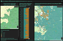
Analysis and statistics of processes and services of the topography and engineering infrastructure information system
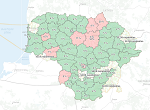
Minicipality spatial data coverage statistical information
Land information system
Land information system
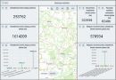
Statistics of the Land Information System (ŽIS) (test)